
Page 402 - Microsoft Word - FY 2020 Adopted Budget Document
P. 402
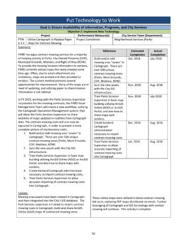
Put Technology to Work


                           Goal 1: Ensure Availability of Information, Programs, and City Services
                                             Objective 2: Implement New Technology
                            Project                 Performance Measure(s)       City Service Team (Department)
             PTW   Utilize Cartegraph to Replace Paper   Project Completion   Neighborhood Services (Parks)
             1.2.3  Maps for Contract Mowing
             Summary:
                                                                    Milestone          Estimated      Actual
             PARD manages contract mowing services for a majority                     Completion    Completion
             of mowing activity at Parks, City Owned Property (COP),   Build and/or edit   Oct. 2018   July 2018
             Municipal Grounds, Medians, and Right of Way (ROW).    mowing area “assets” in
             To provide the mowing location information to vendors,   Cartegraph.  There are
             PARD currently utilizes maps that were created some   over 500 unique
             time ago. Often, due to email attachment size     contract mowing areas
             limitations, maps are printed and then provided to   (Parks, Muni Grounds,
             vendors. The current method presents several      COP, Medians, ROW)
             opportunities for improvement. Many of the maps are in   Sync the new assets   Nov. 2018   Aug. 2018
             need of updating, and utilizing paper to share location   with the City GIS
             information is not optimal.                       infrastructure.
                                                               Train Parks Services   Nov. 2018    July 2018
             In FY 2019, working with the Parks Services Supervisor   Supervisor in basic map
             responsible for the mowing contracts, the PARD Asset   building utilizing ArcGIS
             Management Team will create a new workflow, utilizing   Online (AGO) or ArcGIS
             the Cartegraph Operations Management system, that   Portal, and also how to
             will allow the Parks Services Supervisor to share   share maps with
             weblinks of maps updated in realtime from Cartegraph   vendors.
             data. The contract mowing costs will also now be   Create backend       Dec. 2018     Aug. 2018
             captured in Cartegraph, in order to present a more   Cartegraph
             complete picture of maintenance costs.            administration
                 1.  Build and/or edit mowing area “assets” in   necessary to import
                    Cartegraph.  There are over 500 unique     contract mowing costs
                    contract mowing areas (Parks, Muni Grounds,   Train Parks Services   Jan. 2019   Aug. 2018
                    COP, Medians, ROW)                         Supervisor to allow
                 2.  Sync the new assets with the City GIS     accurate importing of
                    infrastructure.                            contract mowing costs
                 3.  Train Parks Services Supervisor in basic map   into Cartegraph
                    building utilizing ArcGIS Online (AGO) or ArcGIS
                    Portal, and also how to share maps with
                    vendors.
                 4.  Create backend Cartegraph administration
                    necessary to import contract mowing costs.
                 5.  Train Parks Services Supervisor to allow
                    accurate importing of contract mowing costs
                    into Cartegraph.

             Update:
             Mowing area assets have been created in Cartegraph,   These online maps were utilized in latest contract mowing
             and then integrated into the City’s GIS database.  The   bid cycle, replacing PDF maps distributed via email.  Further
             Park Services supervisor is trained to import contract   leveraging of Cartegraph and GIS technology with contact
             mowing costs in Cartegraph, build and share ArcGIS   mowing will continue.  This activity is complete.
             Online (AGO) maps of contracted mowing areas.


                                                             56