
Page 340 - FY 19 Budget Forecast 91218.xlsx
P. 340
INFORMATION TECHNOLOGY FUND
GEOGRAPHIC INFORMATION SERVICES DIVISION
(119-180-19)
DEPARTMENT DESCRIPTION:
The Geographic Information Systems (GIS) division is under the general direction of Information Technology Director.
GIS provides geographic information and geographic data management services to all City departments. The City's
GIS operates to help analyze city infrastructure and assist citizens and employees in making informed decisions
regarding existing conditions and future needs. The GIS division supports Property Assessment, Public Safety,
Economic Development, Permitting, Capital Improvements, Environment, Transportation, Public Works Asset
Management, and many other issues related to city government. Specific services include system integration strategies,
software and data needs analysis, software support, data analysis, data conversion, map production, interactive map
web pages, and geographic database management.
DEPARTMENT/DIVISION GOALS:
1. Manage a centralized GIS database management system to ensure data integrity, accuracy and reliability of citywide
infrastructure.
2. Increase productivity and work efficiency by providing effective GIS solutions to streamline City processes in and
between departments.
3. Provide GIS Support and training for city departments.
4. Collaborate with other agencies through data sharing opportunities.
DEPARTMENT/DIVISION OBJECTIVES:
1. Improve GIS applications and increase the accessibility of GIS data to City staff.
2. Manage advance GIS Web Interface for better data sharing and ensure deliveries of the most current data.
3. Acquire high resolution aerial imagery that can serve numerous purposes for various departments within the city and
provide better data interpretations.
4. Continue to develop new GIS data layers for the Police, Fire, Economic Development, Public Works, Community
Development, and Parks and Recreation departments.
5. Conduct data analysis to support better decision making.
6. Assist Public Works to comply with state and federal standards in storm water management.
7. Manage Public Works Lucity asset management, mobile solution system, and work order system.
8. Provide NETCOM Dispatch Center with geofile, address verification, Automated Vehicle Locator (AVL) map and GIS
support.
9. Import Tarrant County Appraisal District Tax information into GIS and provide tax analysis support.
10. Track infrastructure changes and provide demographic forecast for future planning.
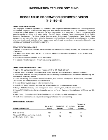
SERVICE LEVEL ANALYSIS:
FY 2018-19
FY 2016-17 FY 2017-18 FY 2017-18 Adopted
SERVICES PROVIDED Actual Budget YE Proj. Budget
Web GIS Users 100 110 110 115
Advanced GIS Users performing Analysis 15 15 15 15
and developing detailed maps
338